Google Updates Satellite Imagery In Google Earth For iOS and Android, Adds Street View
Google announced that it has added new satellite imagery to Google Maps and Google Earth in order to provide clearer images and remove some artifacts. Using NASA’s Landsat 7 satellite and Google Earth Engine technology, Google says it has developed a “seamless, globally-consistent image of the entire planet with a resolution of 15 meters per pixel”. The full image of the earth is 800,000 megapixels.
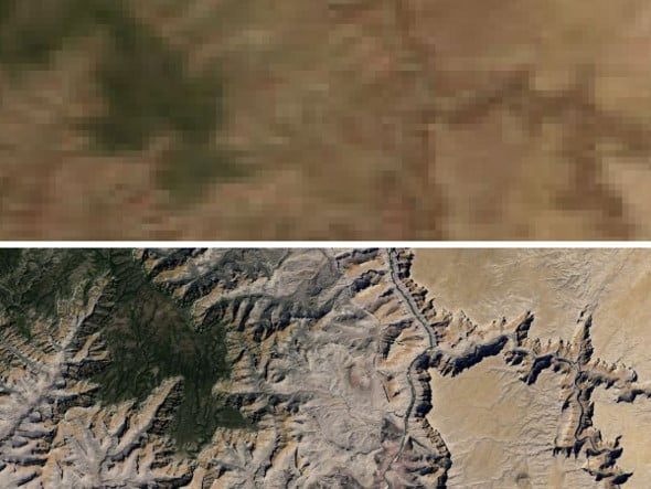
Grand Canyon, before and after new imagery
Google also pledged to update its images further, thanks to the launch of Landsat 8 earlier this year.

Chicago
In the meantime, Google has also added Street View to Google Earth 7.1 for both iOS and Android, so you can explore places around the world at street level--such as Stonehenge. Further, the update offers better directions for public transit, walking, driving, or biking in 3D. The streamlined interface is a nice touch, too.
Stonehenge
It’s continually astonishing to see Google’s Maps and Earth improve as they do; we can’t enough of these images.
Grand Canyon, before and after new imagery
Google also pledged to update its images further, thanks to the launch of Landsat 8 earlier this year.

Chicago
In the meantime, Google has also added Street View to Google Earth 7.1 for both iOS and Android, so you can explore places around the world at street level--such as Stonehenge. Further, the update offers better directions for public transit, walking, driving, or biking in 3D. The streamlined interface is a nice touch, too.

Stonehenge
It’s continually astonishing to see Google’s Maps and Earth improve as they do; we can’t enough of these images.