Mapping the Australian Wildfires, with Google
By now you are probably aware of wildfires that have ravaged the southern state of Victoria in Australia. 108 people are dead at the time of this writing, over 700 homes destroyed, with 850 square miles (2,200 square kilometers) burned.
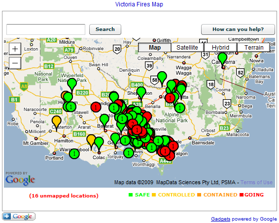
Google engineers have pulled together a Flash map that shows the extent of the tragic wildfires happening.
The map is updated in real-time from the Country Fire Authority (CFA) website via an RSS feed. The number in each marker shows the number of fires at the location. A green marker means the area is called "safe" by the CFA. Yellow means "controlled". Orange means "contained". Red means "ongoing". Unfortunately, it won't embed succesfully in our site, so you'll have to go to their blog post to see it; that's just an image below.
In a blog post, Google said:
We hope that it's of some use to people who may be affected, to emergency services personnel, and that it takes some load off other websites which are being inundated. The map certainly makes the scale of this disaster immediately apparent.