Google Launches Crisis Map as Hurricane Sandy Slams East Coast
Hurricane Sandy has forced hundreds of thousands of people living along the Eastern Seaboard out of their homes, stranding others who ignored the evacuation orders. According to reports, some 60 million people live in the path of the 900-mile storm, which has been pushing 85 MPH winds and waters up to 11 feet tall.
"This is the most catastrophic event that we have faced and been able to plan for in any of our lifetimes," Connecticut Gov. Dan Malloy said, according to CNN.
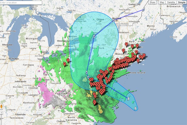
Hurricane Sandy is expected to wreak all kinds of havoc throughout New England and as far as the Appalachians. To help people prepare for and track the storm, Google's Crisis Response team (which was setup during Hurricane Katrina) has launched a Crisis Map (embedded below) where you can track the storm's progress and receive updated emergency information.
On the map you'll find location tracking, public alerts, radar and cloud imagery, evacuation information, shelters, and storm footage.
To all our East Coast readers and anyone in the path of this storm, stock up on supplies and stay safe out there.
"This is the most catastrophic event that we have faced and been able to plan for in any of our lifetimes," Connecticut Gov. Dan Malloy said, according to CNN.
Hurricane Sandy is expected to wreak all kinds of havoc throughout New England and as far as the Appalachians. To help people prepare for and track the storm, Google's Crisis Response team (which was setup during Hurricane Katrina) has launched a Crisis Map (embedded below) where you can track the storm's progress and receive updated emergency information.
On the map you'll find location tracking, public alerts, radar and cloud imagery, evacuation information, shelters, and storm footage.
To all our East Coast readers and anyone in the path of this storm, stock up on supplies and stay safe out there.